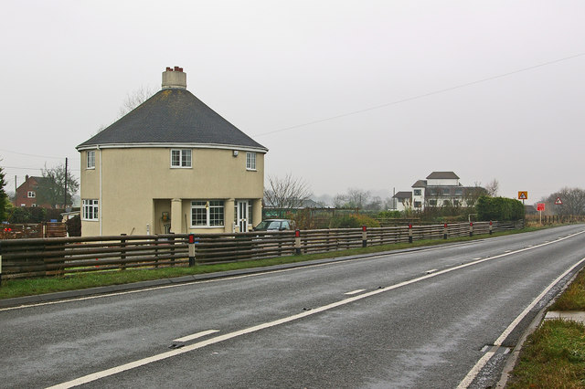
Roundhouse
Introduction
The photograph on this page of Roundhouse by Ian Capper as part of the Geograph project.
The Geograph project started in 2005 with the aim of publishing, organising and preserving representative images for every square kilometre of Great Britain, Ireland and the Isle of Man.
There are currently over 7.5m images from over 14,400 individuals and you can help contribute to the project by visiting https://www.geograph.org.uk

Image: © Ian Capper Taken: 15 Dec 2009
I had originally presumed that this was a former tollhouse, and indeed found reference to it as such at http://www.turnpikes.org.uk. However, Keith Bleddoes, the contributor to the article in the Black Country Bugle referred to below, has been in touch with me to provide the true history. It was in fact built in 1932 and was the Manager's house (and a cafe) of Fenn Green Filling Station which closed in the 1980s. It was originally thatched, but following a fire in 1953 the roof was rebuilt in its present style. In the background is The White Lodge Residential Care Home. The Home's website at http://www.oldfieldcare.co.uk/homes_white_lodge_residential_care_home.aspx suggests that it was built in 1910 but an article from the Black Country Bugle at http://www.blackcountrybugle.co.uk/blackcountrybugle-news/displayarticle.asp?id=74621 suggests a later date of 1937, which seems more likely. According to the article it was built as a pub, the Nautical William, to a design of the architects Webb & Gray of Dudley, modelled on the bridge of the Queen Mary which had been launched a few years earlier in 1934. It is suggested that the pub was due to be called the Queen Mary, but plans were changed when George V died, as it seemed inappropriate to do so when she was in mourning. It was instead given an alternative maritime name. It closed as a pub in 1989, after a few name changes, and was converted to a Nursing Home. For a much fuller account, see the Black Country Bugle article.

