Smethwick Rolfe Street Station
Introduction
The photograph on this page of Smethwick Rolfe Street Station by Michael Westley as part of the Geograph project.
The Geograph project started in 2005 with the aim of publishing, organising and preserving representative images for every square kilometre of Great Britain, Ireland and the Isle of Man.

There are currently over 7.5m images from over 14,400 individuals and you can help contribute to the project by visiting https://www.geograph.org.uk
Smethwick Rolfe Street Station
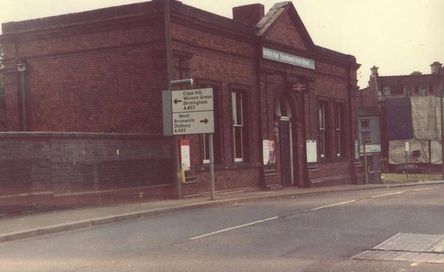
Image: © Michael Westley Taken: Unknown
Entrance to local services at Smethwick. At this time, services from the station were reasonably good, serving at the time 2 local services - the Birmingham to Wolverhampton, and Birmingham to Stourbridge lines - Smethwick Galton Bridge and the additional route through to Snow Hill were only a figment of someone's dreams or imagination at Centro.
Images are licensed for reuse under creativecommons.org/licenses/by-sa/2.0
Image Location
Latitude
52.496563
Longitude
-1.969613