Upper High Street Ashford, 1975
Introduction
The photograph on this page of Upper High Street Ashford, 1975 by John Baker as part of the Geograph project.
The Geograph project started in 2005 with the aim of publishing, organising and preserving representative images for every square kilometre of Great Britain, Ireland and the Isle of Man.

There are currently over 7.5m images from over 14,400 individuals and you can help contribute to the project by visiting https://www.geograph.org.uk
Upper High Street Ashford, 1975
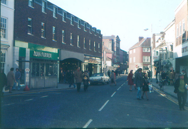
Image: © John Baker Taken: Unknown
The arch to the right of John Farmer led to what was known at the time as The Tufton Centre. Further up the street on the right, on the corner of Castle Street stood The Castle Inn (in this view painted a reddish colour) while to its left and further up New Rents stood Lewis and Hyland's premises which were demolished in 1975.
Images are licensed for reuse under creativecommons.org/licenses/by-sa/2.0
Image Location
Latitude
51.149571
Longitude
0.870241