Collapse on Constitution Hill
Introduction
The photograph on this page of Collapse on Constitution Hill by Natasha Ceridwen de Chroustchoff as part of the Geograph project.
The Geograph project started in 2005 with the aim of publishing, organising and preserving representative images for every square kilometre of Great Britain, Ireland and the Isle of Man.

There are currently over 7.5m images from over 14,400 individuals and you can help contribute to the project by visiting https://www.geograph.org.uk
Collapse on Constitution Hill
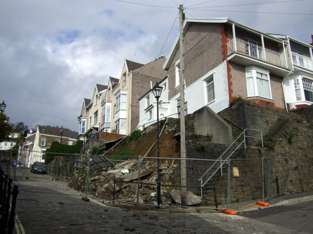
Image: © Natasha Ceridwen de Chroustchoff Taken: 21 Oct 2009
The end of Cromwell Road fell away in July 2009 after a period of heavy rain.
Images are licensed for reuse under creativecommons.org/licenses/by-sa/2.0
Image Location
Latitude
51.62257
Longitude
-3.955738