City & Guilds College, 1964
Introduction
The photograph on this page of City & Guilds College, 1964 by Robin Webster as part of the Geograph project.
The Geograph project started in 2005 with the aim of publishing, organising and preserving representative images for every square kilometre of Great Britain, Ireland and the Isle of Man.

There are currently over 7.5m images from over 14,400 individuals and you can help contribute to the project by visiting https://www.geograph.org.uk
City & Guilds College, 1964
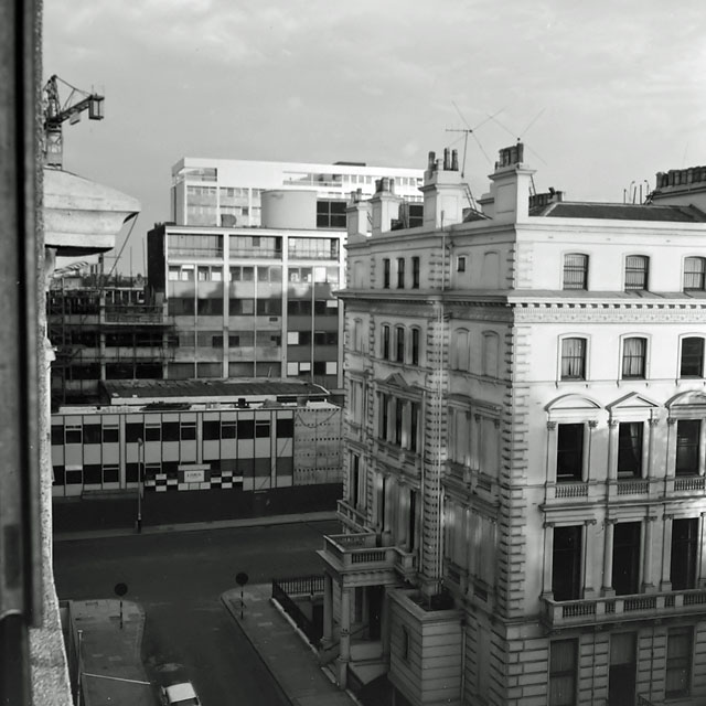
Image: © Robin Webster Taken: Unknown
This Engineering part of Imperial College was still partly being rebuilt at the time. Viewed from the Imperial College South Side (of Princes Gardens) halls of residence across Exhibition Road. The viewpoint building was completed in 1963 and has since been demolished and replaced. The old building at right was not part of the campus.
Images are licensed for reuse under creativecommons.org/licenses/by-sa/2.0
Image Location


Leaflet Map data © OpenStreetMap
Latitude
51.500127
Longitude
-0.174185