Soldierstown Bridge - disused Lagan navigation (1)
Introduction
The photograph on this page of Soldierstown Bridge - disused Lagan navigation (1) by Albert Bridge as part of the Geograph project.
The Geograph project started in 2005 with the aim of publishing, organising and preserving representative images for every square kilometre of Great Britain, Ireland and the Isle of Man.

There are currently over 7.5m images from over 14,400 individuals and you can help contribute to the project by visiting https://www.geograph.org.uk
Soldierstown Bridge - disused Lagan navigation (1)
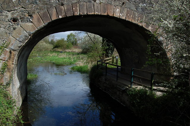
Image: © Albert Bridge Taken: 1 May 2006
The Lagan canal opened in 1794 connecting Belfast and Lough Neagh. It was formally abandoned in 1954. The photograph shows Soldierstown Bridge between Lisburn and Aghalee looking towards Lough Neagh. The canal is mainly overgrown but the towpath remains a popular walk. Continue to Image See also Image
Images are licensed for reuse under creativecommons.org/licenses/by-sa/2.0
Image Location
Latitude
54.500514
Longitude
-6.227204