Marylebone: Wimpole House, W1
Introduction
The photograph on this page of Marylebone: Wimpole House, W1 by Nigel Cox as part of the Geograph project.
The Geograph project started in 2005 with the aim of publishing, organising and preserving representative images for every square kilometre of Great Britain, Ireland and the Isle of Man.

There are currently over 7.5m images from over 14,400 individuals and you can help contribute to the project by visiting https://www.geograph.org.uk
Marylebone: Wimpole House, W1
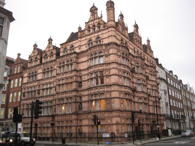
Image: © Nigel Cox Taken: 3 Dec 2009
This Gothic Victorian extravagance in terracotta is a prominent insert into the surrounds of the austere and simple Georgian houses of the Edward Harley estate, at the junction of Wimpole Street with New Cavendish Street. It dates from 1893, so it is about 150 years newer than the buildings around it. The foundation stone was laid in September 1892 by Mary Mason Lithgow. The FreeBMD website http://freebmd.rootsweb.com/ has a transcribed record of the marriage of a Samuel Lithgow to a Mary Mason Hall in 1857 in the Marylebone Registration District, and the death of a Mary Mason Lithgow aged 73 in 1900 in the Hendon Registration District so this was almost certainly her.
Images are licensed for reuse under creativecommons.org/licenses/by-sa/2.0
Image Location
Latitude
51.519139
Longitude
-0.147912