Marylebone: Upper Wimpole Street, W1
Introduction
The photograph on this page of Marylebone: Upper Wimpole Street, W1 by Nigel Cox as part of the Geograph project.
The Geograph project started in 2005 with the aim of publishing, organising and preserving representative images for every square kilometre of Great Britain, Ireland and the Isle of Man.

There are currently over 7.5m images from over 14,400 individuals and you can help contribute to the project by visiting https://www.geograph.org.uk
Marylebone: Upper Wimpole Street, W1
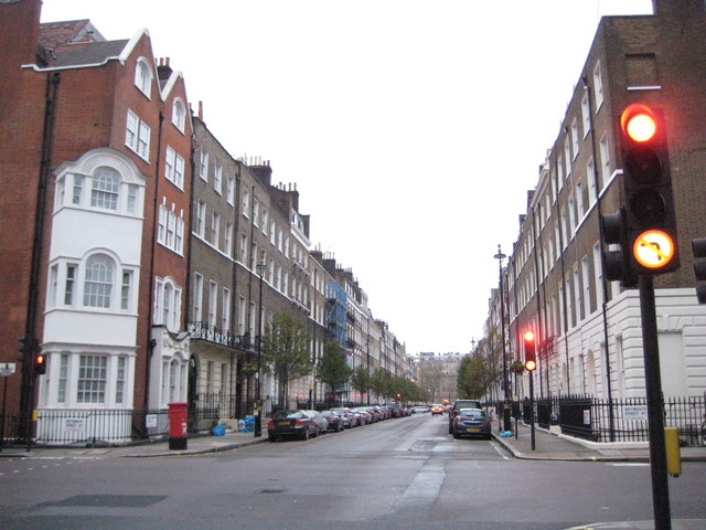
Image: © Nigel Cox Taken: 3 Dec 2009
Most of this area of Marylebone was built up by about 1793 and became associated with the medical and dental professions, although the reasons for the attraction are not clear. The name Wimpole comes from the location of the country estate in Cambridgeshire owned by the original landlord, Edward Harley, Earl of Oxford, after whom the parallel Harley Street is named. This image was taken looking north up Upper Wimpole Street from its junction with Weymouth Street.
Images are licensed for reuse under creativecommons.org/licenses/by-sa/2.0
Image Location
Latitude
51.520874
Longitude
-0.149572