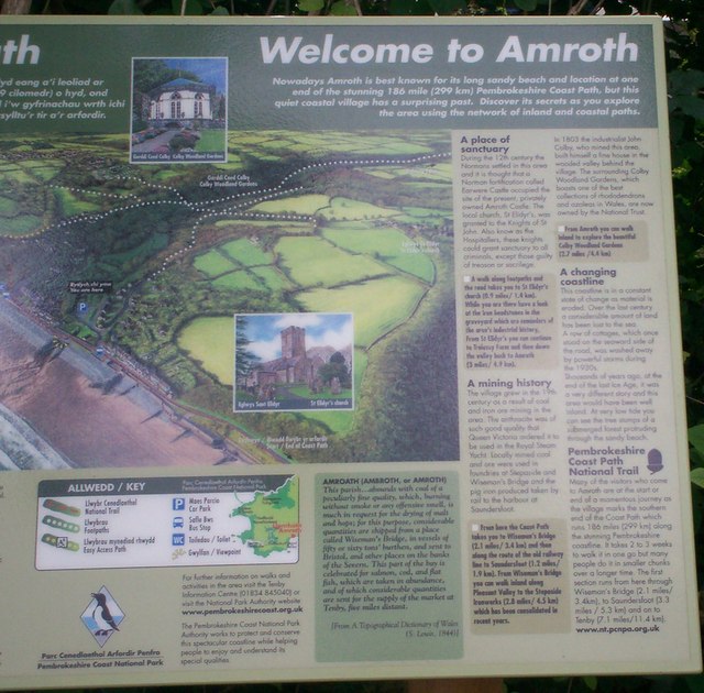
New Information Board in Amroth Carpark
Introduction
The photograph on this page of New Information Board in Amroth Carpark by welshbabe as part of the Geograph project.
The Geograph project started in 2005 with the aim of publishing, organising and preserving representative images for every square kilometre of Great Britain, Ireland and the Isle of Man.
There are currently over 7.5m images from over 14,400 individuals and you can help contribute to the project by visiting https://www.geograph.org.uk

Image: © welshbabe Taken: 29 Aug 2009
This has caused some controversy regarding the history included about Amroth Castle. Taken from http://www.pembrokeshirevirtualmuseum.co.uk/main_menu/places_to_visit/castles/earthwork_castles/amroth/amroth_castle.html Amroth Castle It is a common mistake to believe that Amroth Castle is the large grand building located in the centre of the village next to the caravan park. Although this is called Amroth Castle, it is a fortified mansion that was built in 1800 by Captain James Ackland. The actual site of the medieval castle is located approximately half a mile north of the village on private farmland. It is a motte castle situated on high land overlooking Carmarthen Bay. At present it is very overgrown and the remains are hard to identify. The exact origins of the castle are unknown, although it is suggested that it was constructed by the de Say family near the end of the 11th Century. The castle passed to the Elliot family in the 14th Century and they apparently built a new stone castle on a site closer to the bay. This could well be the site of the modern fortified manor house which is often referred to as Amroth Castle.

