Looking north at Gloucester Place towards Marylebone Road
Introduction
The photograph on this page of Looking north at Gloucester Place towards Marylebone Road by Andy F as part of the Geograph project.
The Geograph project started in 2005 with the aim of publishing, organising and preserving representative images for every square kilometre of Great Britain, Ireland and the Isle of Man.

There are currently over 7.5m images from over 14,400 individuals and you can help contribute to the project by visiting https://www.geograph.org.uk
Looking north at Gloucester Place towards Marylebone Road
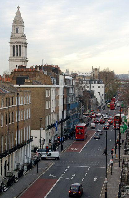
Image: © Andy F Taken: 4 Dec 2009
Looking north along Gloucester Place. The tower on the left of the photo is atop the former offices of the Borough of St Marylebone (see [http://www.geograph.org.uk/photo/586617] ).
Images are licensed for reuse under creativecommons.org/licenses/by-sa/2.0
Image Location
Latitude
51.520657
Longitude
-0.158662