Old MacDonalds Farm Park
Introduction
The photograph on this page of Old MacDonalds Farm Park by Martin Addison as part of the Geograph project.
The Geograph project started in 2005 with the aim of publishing, organising and preserving representative images for every square kilometre of Great Britain, Ireland and the Isle of Man.

There are currently over 7.5m images from over 14,400 individuals and you can help contribute to the project by visiting https://www.geograph.org.uk
Old MacDonalds Farm Park
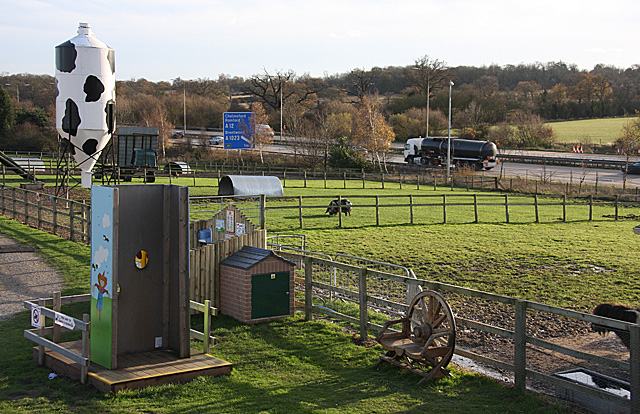
Image: © Martin Addison Taken: 28 Nov 2009
Looking across fields containing Shetland Ponies, Pigs and Goats towards the M25 motorway. The sign on the motorway indicates the next junction for the A12 to Romford and the A1023 for Brentwood. In the foreground is a photobooth allowing people to put their heads through and be photographed as farmers. Behind that there is one of the numerous washing facilities that are positioned around the farm. Reminders to wash your hands after touching the animals are everywhere.
Images are licensed for reuse under creativecommons.org/licenses/by-sa/2.0
Image Location


Leaflet Map data © OpenStreetMap
Latitude
51.625265
Longitude
0.235952