Foss Flood Barrier
Introduction
The photograph on this page of Foss Flood Barrier by Michael Jagger as part of the Geograph project.
The Geograph project started in 2005 with the aim of publishing, organising and preserving representative images for every square kilometre of Great Britain, Ireland and the Isle of Man.

There are currently over 7.5m images from over 14,400 individuals and you can help contribute to the project by visiting https://www.geograph.org.uk
Foss Flood Barrier
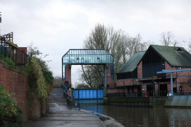
Image: © Michael Jagger Taken: 5 Dec 2009
Taken upstream, note the pump house to the right of the barrier with the water intake to the right of the pump house. The Foss Barrier was built in 1989 as part of a flood alleviation scheme following the 1982 floods. It is located at St Georges Field in York where the River Foss meets the River Ouse. The barrier is a 16 tonne gate which is lowered into the River Foss to stop the Foss levels from rising flood waters on the River Ouse. It also has eight pumps capable of pumping 32 cubic metres of water per second - which is 32 tonnes of water every second. for more details see: http://www.environment-agency.gov.uk/news/57552.aspx (I think the mathematics are slightly incorrect as one cubic metre weighs one tonne) http://www.kirklees-ednet.org.uk/subjects/geog/resources/ks34/flooding/info-packs/group-B-%28EA%29/EA-York-flood-protection-8-pages.pdf
Images are licensed for reuse under creativecommons.org/licenses/by-sa/2.0
Image Location
Latitude
53.952997
Longitude
-1.078204