Trig point on Churchdown Hill
Introduction
The photograph on this page of Trig point on Churchdown Hill by Philip Halling as part of the Geograph project.
The Geograph project started in 2005 with the aim of publishing, organising and preserving representative images for every square kilometre of Great Britain, Ireland and the Isle of Man.

There are currently over 7.5m images from over 14,400 individuals and you can help contribute to the project by visiting https://www.geograph.org.uk
Trig point on Churchdown Hill
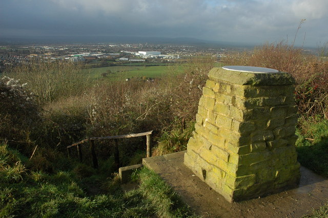
Image: © Philip Halling Taken: 5 Dec 2009
This trig point on Churchdown Hill (also known as Chosen Hill) is in this grid square by just a few feet. Here it is pictured with the viewed to the west over the city of Gloucester and the high ground of the Forest of Dean beyond.
Images are licensed for reuse under creativecommons.org/licenses/by-sa/2.0
Image Location


Leaflet Map data © OpenStreetMap
Latitude
51.868005
Longitude
-2.175977