Four Oaks Station
Introduction
The photograph on this page of Four Oaks Station by Michael Westley as part of the Geograph project.
The Geograph project started in 2005 with the aim of publishing, organising and preserving representative images for every square kilometre of Great Britain, Ireland and the Isle of Man.

There are currently over 7.5m images from over 14,400 individuals and you can help contribute to the project by visiting https://www.geograph.org.uk
Four Oaks Station
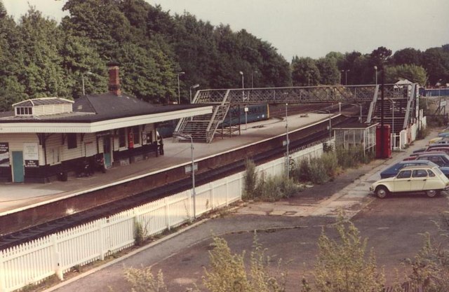
Image: © Michael Westley Taken: Unknown
Taken from Lichfield Road, opposite the church, the car park and platform furniture have changed since this photo - footbridge replaced, modifications to building and shelters, and of course electrification. During the early years of the cross-city service, Four Oaks was terminus for many trains (the left-hand platform behind the buildings), whilst fewer trains continued to Blake Street before returning to Birmingham and beyond.
Images are licensed for reuse under creativecommons.org/licenses/by-sa/2.0
Image Location
Latitude
52.579869
Longitude
-1.828474