Sluice, Washpit Mills, Cartworth
Introduction
The photograph on this page of Sluice, Washpit Mills, Cartworth by Humphrey Bolton as part of the Geograph project.
The Geograph project started in 2005 with the aim of publishing, organising and preserving representative images for every square kilometre of Great Britain, Ireland and the Isle of Man.

There are currently over 7.5m images from over 14,400 individuals and you can help contribute to the project by visiting https://www.geograph.org.uk
Sluice, Washpit Mills, Cartworth
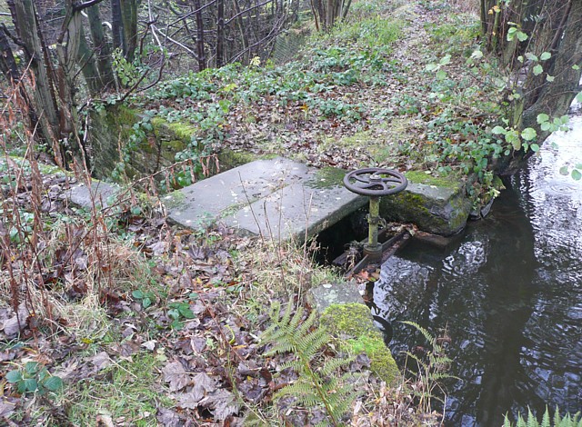
Image: © Humphrey Bolton Taken: 5 Nov 2009
This looks to be still in working order, and could be used to lower the water level in the millpond for maintenance work. The water would flow into the adjacent River Ribble.
Images are licensed for reuse under creativecommons.org/licenses/by-sa/2.0
Image Location
Latitude
53.55494
Longitude
-1.788637