Staple Road in Jarrow
Introduction
The photograph on this page of Staple Road in Jarrow by Vin Mullen as part of the Geograph project.
The Geograph project started in 2005 with the aim of publishing, organising and preserving representative images for every square kilometre of Great Britain, Ireland and the Isle of Man.

There are currently over 7.5m images from over 14,400 individuals and you can help contribute to the project by visiting https://www.geograph.org.uk
Staple Road in Jarrow
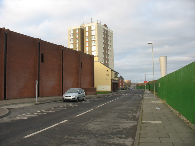
Image: © Vin Mullen Taken: 26 Dec 2008
Staple Road looking North in Jarrow. On the left of the picture is Jarrow Community Centre. Centre is the Royal Oak public House ('Longbar') Behind is Monastery Court High rise flats. And to the right of the picture is the ventilation shaft off the Tyne Tunnel. The fence contains the construction site of the new Tyne Tunnel
Images are licensed for reuse under creativecommons.org/licenses/by-sa/2.0
Image Location


Leaflet Map data © OpenStreetMap
Latitude
54.980941
Longitude
-1.484661