Dassett Road
Introduction
The photograph on this page of Dassett Road by Stephen Richards as part of the Geograph project.
The Geograph project started in 2005 with the aim of publishing, organising and preserving representative images for every square kilometre of Great Britain, Ireland and the Isle of Man.

There are currently over 7.5m images from over 14,400 individuals and you can help contribute to the project by visiting https://www.geograph.org.uk
Dassett Road
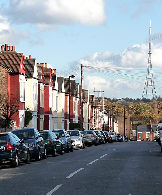
Image: © Stephen Richards Taken: Unknown
Looking east from Knight's Hill. The road is named after a now-demolished large house called Burton Dassett. These houses were probably built in the second half of the C19th. The development of West Norwood began with the breaking up of Lord Thurlow's estate after his death in 1806, but it accelerated greatly with the arrival of the Crystal Palace railway in 1856; between 1851 and 1901 the population of the district of St. Luke's, Norwood increased from around 4,000 to around 36,000. In the distance are trees in Norwood Park and the Crystal Palace television mast.
Images are licensed for reuse under creativecommons.org/licenses/by-sa/2.0
Image Location
Latitude
51.425448
Longitude
-0.103659