Cheviot Road
Introduction
The photograph on this page of Cheviot Road by Stephen Richards as part of the Geograph project.
The Geograph project started in 2005 with the aim of publishing, organising and preserving representative images for every square kilometre of Great Britain, Ireland and the Isle of Man.

There are currently over 7.5m images from over 14,400 individuals and you can help contribute to the project by visiting https://www.geograph.org.uk
Cheviot Road
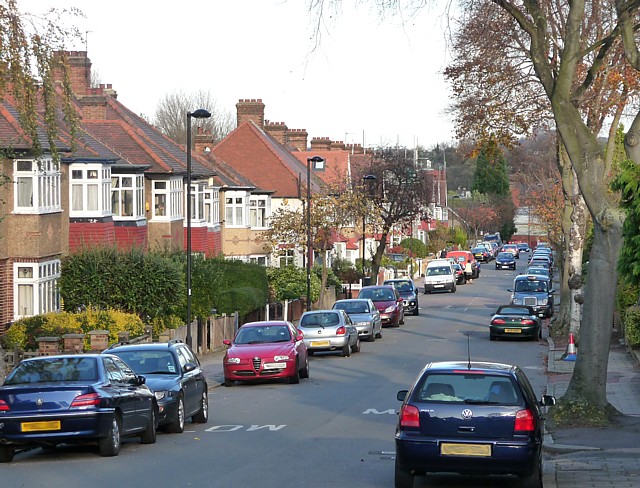
Image: © Stephen Richards Taken: Unknown
Looking north-east towards Knight's Hill. Most of West Norwood was developed in Victorian and Edwardian times but there is also a fair amount of housing from between the wars.
Images are licensed for reuse under creativecommons.org/licenses/by-sa/2.0
Image Location
Latitude
51.426613
Longitude
-0.108933