Rookery Farm, Steventon
Introduction
The photograph on this page of Rookery Farm, Steventon by Howard Fuller as part of the Geograph project.
The Geograph project started in 2005 with the aim of publishing, organising and preserving representative images for every square kilometre of Great Britain, Ireland and the Isle of Man.

There are currently over 7.5m images from over 14,400 individuals and you can help contribute to the project by visiting https://www.geograph.org.uk
Rookery Farm, Steventon
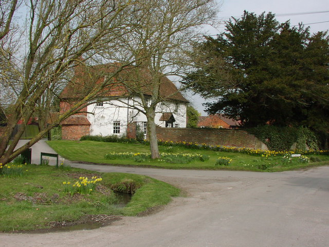
Image: © Howard Fuller Taken: 24 Mar 2002
Built in the mid-17th Century as a timber-framed 'hall house' round a central chalkstone chimney. Queen Anne changes to the interior, and 'cased' in the late-19th Century. Note the brick bulge of the bread oven. Ceased to be part of an active farm in 1953.
Images are licensed for reuse under creativecommons.org/licenses/by-sa/2.0
Image Location
Latitude
51.620409
Longitude
-1.329735