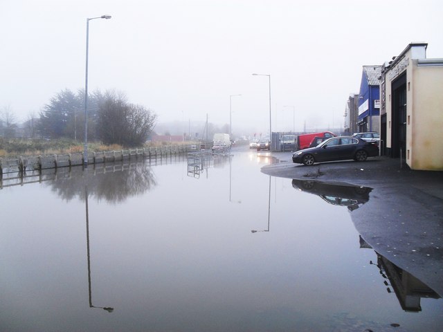
Fermanagh Floods 2009 (12 of 19): Derrychara Link
Introduction
The photograph on this page of Fermanagh Floods 2009 (12 of 19): Derrychara Link by Dean Molyneaux as part of the Geograph project.
The Geograph project started in 2005 with the aim of publishing, organising and preserving representative images for every square kilometre of Great Britain, Ireland and the Isle of Man.
There are currently over 7.5m images from over 14,400 individuals and you can help contribute to the project by visiting https://www.geograph.org.uk

Image: © Dean Molyneaux Taken: 28 Nov 2009
After thirty-five consecutive days of rain in County Fermanagh throughout November 2009, the water levels on Lough Erne rose to 158ft above sea level (Ballyshannon). This was the highest since records began in 1956. The busy county town of Enniskillen didn't escape the high water by any means, here, Derrychara Link - which provides access from the Erneside Shopping Centre to Tesco as well as to a lot of commercial premises - finds itself impassible. Back to:Image Forward to:Image

