Aerial photo of St Mary's Drive and Benfleet electricity substation
Introduction
The photograph on this page of Aerial photo of St Mary's Drive and Benfleet electricity substation by Edward Clack as part of the Geograph project.
The Geograph project started in 2005 with the aim of publishing, organising and preserving representative images for every square kilometre of Great Britain, Ireland and the Isle of Man.

There are currently over 7.5m images from over 14,400 individuals and you can help contribute to the project by visiting https://www.geograph.org.uk
Aerial photo of St Mary's Drive and Benfleet electricity substation
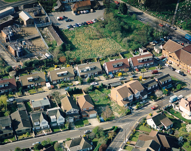
Image: © Edward Clack Taken: 29 Mar 1990
St Mary's Drive runs from the lower left to the mid-lower right. The electricity substation is in the upper left, and is seen from the other direction in Image The road in the upper right is Benfleet High Road, and the green area in the corner is St Mary's churchyard. The white building just visible in the top centre is the Anchor pub, with the pub car park below it. The green area below that is now built on.
Images are licensed for reuse under creativecommons.org/licenses/by-sa/2.0
Image Location
Latitude
51.545006
Longitude
0.565336