River Kensey
Introduction
The photograph on this page of River Kensey by Derek Harper as part of the Geograph project.
The Geograph project started in 2005 with the aim of publishing, organising and preserving representative images for every square kilometre of Great Britain, Ireland and the Isle of Man.

There are currently over 7.5m images from over 14,400 individuals and you can help contribute to the project by visiting https://www.geograph.org.uk
River Kensey
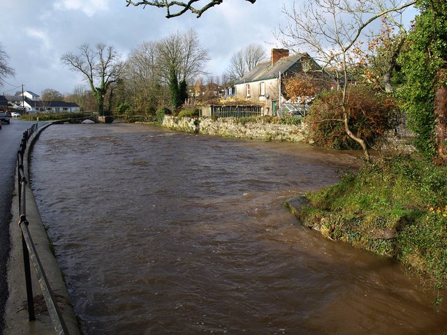
Image: © Derek Harper Taken: 23 Nov 2009
The swollen river seen from Riverside just west of St Thomas Road, with the upstream tip of an island on the right, and Image just keeping above the water level.
Images are licensed for reuse under creativecommons.org/licenses/by-sa/2.0
Image Location
Latitude
50.641457
Longitude
-4.365762