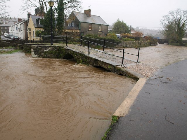
Prior's Bridge, Launceston
Introduction
The photograph on this page of Prior's Bridge, Launceston by Derek Harper as part of the Geograph project.
The Geograph project started in 2005 with the aim of publishing, organising and preserving representative images for every square kilometre of Great Britain, Ireland and the Isle of Man.
There are currently over 7.5m images from over 14,400 individuals and you can help contribute to the project by visiting https://www.geograph.org.uk

Image: © Derek Harper Taken: 23 Nov 2009
The level of the water is more clearly shown without sunshine - compare Image, taken nearly an hour and a half later. The height in relation to the right-hand arches can be compared with Image There seems to be confusion about the name of the bridge. The most detailed OS map has "St Thomas Bridge", and the listed building description states "West Bridge RIVERSIDE. Also known as: St Thomas Bridge" http://www.imagesofengland.org.uk/details/default.aspx?id=370137 . But this would surely confuse with http://www.imagesofengland.org.uk/Details/Default.aspx?id=370111&mode=adv , where the nearby road bridge is also called "St Thomas's Bridge". http://www.historic-cornwall.org.uk/csus/towns/launceston/csus_launceston_report_2005R051.pdf gives "Prior's Bridge".

