New housing in Stainton
Introduction
The photograph on this page of New housing in Stainton by Andy Waddington as part of the Geograph project.
The Geograph project started in 2005 with the aim of publishing, organising and preserving representative images for every square kilometre of Great Britain, Ireland and the Isle of Man.

There are currently over 7.5m images from over 14,400 individuals and you can help contribute to the project by visiting https://www.geograph.org.uk
New housing in Stainton
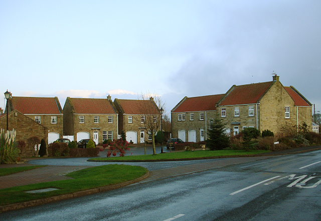
Image: © Andy Waddington Taken: 25 Nov 2009
Streatlam Close is just off the road through the village and whilst not quite the same as a single row of houses along the road, it seems like classic ribbon development nonetheless, as it extends the habitations on the north side of the road further east in a village which is already elongated east-west along a single road. Although red roofs are not typical of older properties in the area, there do seem to be quite a few others in Stainton.
Images are licensed for reuse under creativecommons.org/licenses/by-sa/2.0
Image Location
Latitude
54.56195
Longitude
-1.886151