Aerial view of west Hadleigh
Introduction
The photograph on this page of Aerial view of west Hadleigh by Edward Clack as part of the Geograph project.
The Geograph project started in 2005 with the aim of publishing, organising and preserving representative images for every square kilometre of Great Britain, Ireland and the Isle of Man.

There are currently over 7.5m images from over 14,400 individuals and you can help contribute to the project by visiting https://www.geograph.org.uk
Aerial view of west Hadleigh
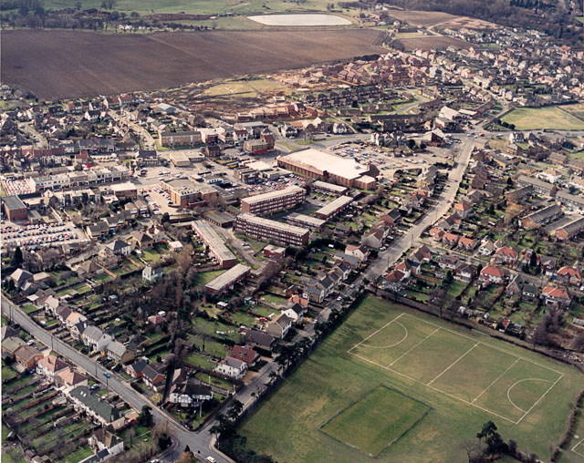
Image: © Edward Clack Taken: Unknown
This view looks down New Road (leading from bottom centre to upper right). The A13 (London Road) runs horizontally across above centre. The large flat-topped building near where New Road meets the London Road (with the car park) was then a Safeway Supermarket. It is now a branch of Morrisons. The building on the London Road to the upper left of the supermarket is Hadleigh Fire Station, now recently closed. Image The playing fields to the lower right are part of the John Burrows recreation ground. The date is approximate.
Images are licensed for reuse under creativecommons.org/licenses/by-sa/2.0
Image Location
Latitude
51.554908
Longitude
0.605711