Towards Aberargie
Introduction
The photograph on this page of Towards Aberargie by Colin Inverarity as part of the Geograph project.
The Geograph project started in 2005 with the aim of publishing, organising and preserving representative images for every square kilometre of Great Britain, Ireland and the Isle of Man.

There are currently over 7.5m images from over 14,400 individuals and you can help contribute to the project by visiting https://www.geograph.org.uk
Towards Aberargie
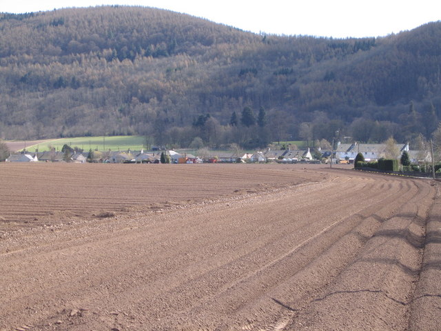
Image: © Colin Inverarity Taken: 23 Apr 2006
The steep rise from the flat sandy plain of the Earn to the larch covered slopes of the Ochils is fairly obvious here. Aberagie is one of a number of villages along the line of the scarp. North facing it may be but it was having a lot of sun on this occasion.
Images are licensed for reuse under creativecommons.org/licenses/by-sa/2.0
Image Location


Leaflet Map data © OpenStreetMap
Latitude
56.328937
Longitude
-3.356778