The North Eastern End of Fore Street, St Columb
Introduction
The photograph on this page of The North Eastern End of Fore Street, St Columb by Tony Atkin as part of the Geograph project.
The Geograph project started in 2005 with the aim of publishing, organising and preserving representative images for every square kilometre of Great Britain, Ireland and the Isle of Man.

There are currently over 7.5m images from over 14,400 individuals and you can help contribute to the project by visiting https://www.geograph.org.uk
The North Eastern End of Fore Street, St Columb
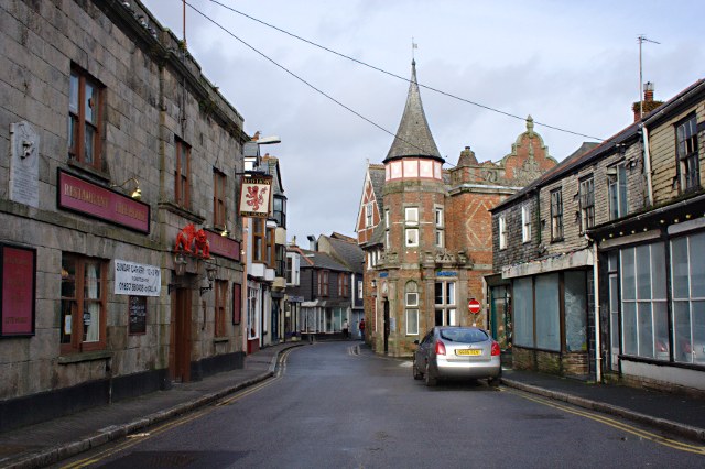
Image: © Tony Atkin Taken: 22 Nov 2009
Fore Street is the narrow main road through the Centre of St Columb. The red brick building at the centre of the photo is the Barclays Bank Building, on the left is the Red Lion Inn and the less distinguished looking shops on the right have slate-faced walls, not uncommon in this town.
Images are licensed for reuse under creativecommons.org/licenses/by-sa/2.0
Image Location
Latitude
50.434784
Longitude
-4.940457