The Water of Girvan Flood Plain
Introduction
The photograph on this page of The Water of Girvan Flood Plain by Mary and Angus Hogg as part of the Geograph project.
The Geograph project started in 2005 with the aim of publishing, organising and preserving representative images for every square kilometre of Great Britain, Ireland and the Isle of Man.

There are currently over 7.5m images from over 14,400 individuals and you can help contribute to the project by visiting https://www.geograph.org.uk
The Water of Girvan Flood Plain
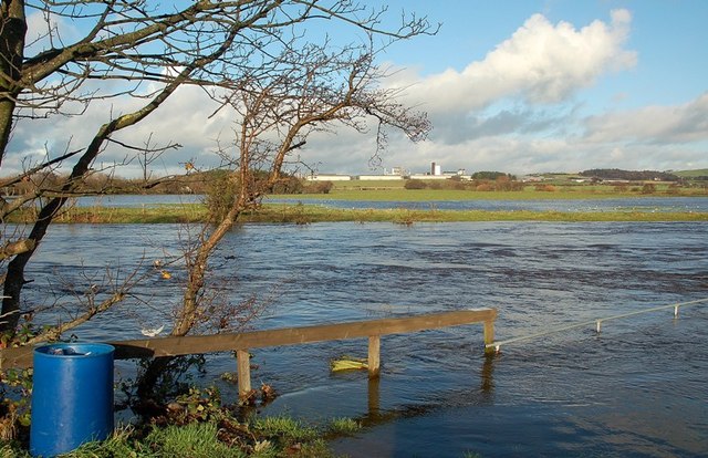
Image: © Mary and Angus Hogg Taken: 17 Nov 2009
It's easy to see why this feature is called a flood plain. The flat land alongside the river is able to accept the flood water, leaving farm buildings on higher ground safe. The buildings in the background, in the next square, are in Grangestone Industrial Estate.
Images are licensed for reuse under creativecommons.org/licenses/by-sa/2.0
Image Location
Latitude
55.250229
Longitude
-4.838433