Barlow Pinfold
Introduction
The photograph on this page of Barlow Pinfold by Toby Speight as part of the Geograph project.
The Geograph project started in 2005 with the aim of publishing, organising and preserving representative images for every square kilometre of Great Britain, Ireland and the Isle of Man.

There are currently over 7.5m images from over 14,400 individuals and you can help contribute to the project by visiting https://www.geograph.org.uk
Barlow Pinfold
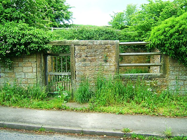
Image: © Toby Speight Taken: 4 Jun 2005
Also known as Wilkin Hill Pinfold, this pinfold is a Grade II Listed Building (http://www.britishlistedbuildings.co.uk/en-79497-wilkin-hill-pinfold-barlow-derbyshire ). It was owned by the Duke of Rutland until the 1890s, when it was gifted to the parish council. It was restored to its present condition in 1985. The word 'Barlow' was removed from the lintel during World War II, when road signs in much of Britain were removed in case of invasion. Pinfolds were used to impound animals that were found straying, and a fee was charged for their release.
Images are licensed for reuse under creativecommons.org/licenses/by-sa/2.0
Image Location
Latitude
53.265857
Longitude
-1.488409