All Hallows nave
Introduction
The photograph on this page of All Hallows nave by Richard Croft as part of the Geograph project.
The Geograph project started in 2005 with the aim of publishing, organising and preserving representative images for every square kilometre of Great Britain, Ireland and the Isle of Man.

There are currently over 7.5m images from over 14,400 individuals and you can help contribute to the project by visiting https://www.geograph.org.uk
All Hallows nave
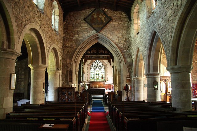
Image: © Richard Croft Taken: 1 Jun 2009
Looking east towards the 19th century chancel arch with arcades of c1200, the north one still Romanesque, the Gothic south one slightly later
Images are licensed for reuse under creativecommons.org/licenses/by-sa/2.0
Image Location
Latitude
53.323443
Longitude
-1.259372