Herstmonceux Place
Introduction
The photograph on this page of Herstmonceux Place by Miss Helen Mary James (deceased) as part of the Geograph project.
The Geograph project started in 2005 with the aim of publishing, organising and preserving representative images for every square kilometre of Great Britain, Ireland and the Isle of Man.

There are currently over 7.5m images from over 14,400 individuals and you can help contribute to the project by visiting https://www.geograph.org.uk
Herstmonceux Place
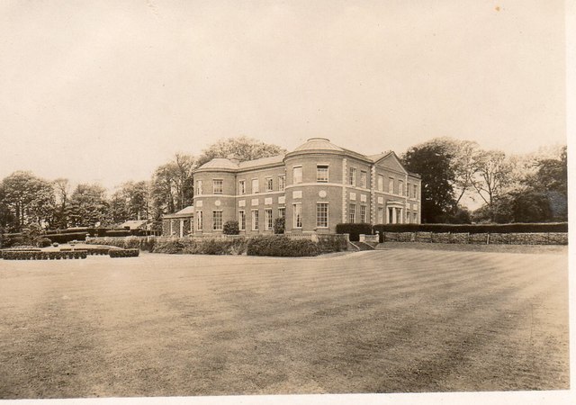
Image: © Miss Helen Mary James (deceased) Taken: Unknown
This picture shows Herstmonceux Place, circa 1932, after which it ceased to be a private house and was divided into flats. The north front of the house (not visible in this photo) was built in the late 17th century. The south and east fronts (seen here) were designed by Samuel Wyatt in 1778. The white panels are made of Coade Stone http://en.wikipedia.org/wiki/Coade_stone
Images are licensed for reuse under creativecommons.org/licenses/by-sa/2.0
Image Location
Latitude
50.875617
Longitude
0.328381