Engine Lane, Eastwood
Introduction
The photograph on this page of Engine Lane, Eastwood by Stephen McKay as part of the Geograph project.
The Geograph project started in 2005 with the aim of publishing, organising and preserving representative images for every square kilometre of Great Britain, Ireland and the Isle of Man.

There are currently over 7.5m images from over 14,400 individuals and you can help contribute to the project by visiting https://www.geograph.org.uk
Engine Lane, Eastwood
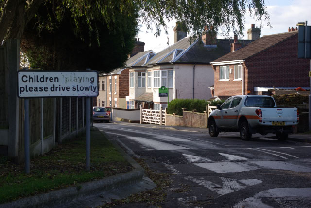
Image: © Stephen McKay Taken: 15 Nov 2009
At this point Engine Lane passes out of the Moorgreen Industrial Park and into a residential area of Eastwood, which no doubt explains the warning about children playing. A height barrier behind the photographer prevents lorries using this route. At one time a mineral railway passed across the road here, giving access to Moorgreen Colliery; the modern house with the 'for sale' board appears to have been built across its former route.
Images are licensed for reuse under creativecommons.org/licenses/by-sa/2.0
Image Location
Latitude
53.024391
Longitude
-1.291488