Selmeston Court
Introduction
The photograph on this page of Selmeston Court by Simon Carey as part of the Geograph project.
The Geograph project started in 2005 with the aim of publishing, organising and preserving representative images for every square kilometre of Great Britain, Ireland and the Isle of Man.

There are currently over 7.5m images from over 14,400 individuals and you can help contribute to the project by visiting https://www.geograph.org.uk
Selmeston Court
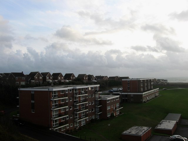
Image: © Simon Carey Taken: 15 Nov 2009
The name of the block of flats in the foreground, Litlington Court are the ones beyond. These along with two others out of shot to the right were built in the 1990s on the site of an old tidal inlet that has been cut off to the south by an embankment carrying the Lewes-Seaford railway line and to the north by another embankment that was built in 1963 to carry the Buckle By-Pass. The houses on the higher ground to the left are in Friston Close.
Images are licensed for reuse under creativecommons.org/licenses/by-sa/2.0
Image Location
Latitude
50.779332
Longitude
0.088821