A14 from overbridge, Haughley
Introduction
The photograph on this page of A14 from overbridge, Haughley by John Goldsmith as part of the Geograph project.
The Geograph project started in 2005 with the aim of publishing, organising and preserving representative images for every square kilometre of Great Britain, Ireland and the Isle of Man.

There are currently over 7.5m images from over 14,400 individuals and you can help contribute to the project by visiting https://www.geograph.org.uk
A14 from overbridge, Haughley
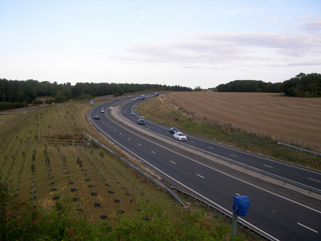
Image: © John Goldsmith Taken: 20 Sep 2009
This is the point where the new route of the A14 deviates from the old at Haughley bends. The old westbound carriageway can be seen beyond the big blue P sign. The old eastbound carriageway passes through the trees left of that. One of the 4 cameras that used to enforce the old reduced speed limit sits in the foreground. Not long ago there was a Geograph discussion about the location of the road in the UK with the most lanes side by side - I bet no-one expected a contender in rural Suffolk: 4 lanes of current A14, 2 lanes of old A14 used as minor road, 1 lane of old road used as cycle track, 1 lane of old road with surface removed but still usable, and a dirt track almost alongside (See Image)
Images are licensed for reuse under creativecommons.org/licenses/by-sa/2.0
Image Location
Latitude
52.21774
Longitude
0.947719