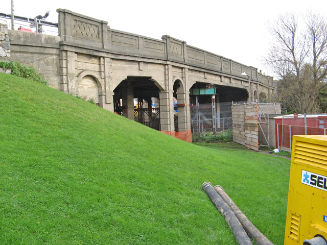
Maesdu Bridge
Introduction
The photograph on this page of Maesdu Bridge by Jonathan Wilkins as part of the Geograph project.
The Geograph project started in 2005 with the aim of publishing, organising and preserving representative images for every square kilometre of Great Britain, Ireland and the Isle of Man.
There are currently over 7.5m images from over 14,400 individuals and you can help contribute to the project by visiting https://www.geograph.org.uk

Image: © Jonathan Wilkins Taken: 13 Nov 2009
This concrete structure spanning the railway to Llandudno has been a source of concern for many years. Built in concrete, structural deterioration advanced so far that it was necessary to install a set of girders beneath the central span to support the road deck. A weight limit of 7.5 tonnes has been in force since that time. This image was captured days before the demolition was scheduled, and plant and security fencing can be seen in place.

