Aerial view between Hadleigh and Daws Heath
Introduction
The photograph on this page of Aerial view between Hadleigh and Daws Heath by Edward Clack as part of the Geograph project.
The Geograph project started in 2005 with the aim of publishing, organising and preserving representative images for every square kilometre of Great Britain, Ireland and the Isle of Man.

There are currently over 7.5m images from over 14,400 individuals and you can help contribute to the project by visiting https://www.geograph.org.uk
Aerial view between Hadleigh and Daws Heath
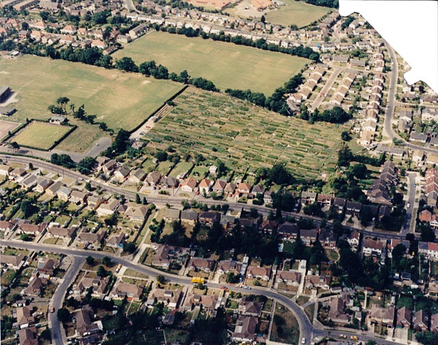
Image: © Edward Clack Taken: Unknown
This is the area just north of Image The road across the centre is Daws Heath Road, running between Hadleigh to the left (south) and Daws Heath to the right (north). The patchwork area just above centre are allotments, seen at ground level in Image To the left of these, the open area is part of the John Burrows recreation grounds. The square at the left centre is a bowling green. The date given here is approximate.
Images are licensed for reuse under creativecommons.org/licenses/by-sa/2.0
Image Location
Latitude
51.558225
Longitude
0.610229