View of Crosskeys and the Ebbw Valley
Introduction
The photograph on this page of View of Crosskeys and the Ebbw Valley by Robin Drayton as part of the Geograph project.
The Geograph project started in 2005 with the aim of publishing, organising and preserving representative images for every square kilometre of Great Britain, Ireland and the Isle of Man.

There are currently over 7.5m images from over 14,400 individuals and you can help contribute to the project by visiting https://www.geograph.org.uk
View of Crosskeys and the Ebbw Valley
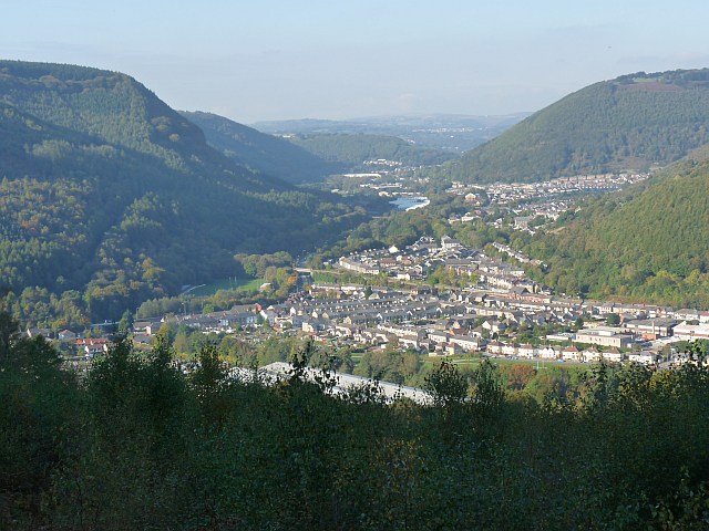
Image: © Robin Drayton Taken: 14 Oct 2009
Taken from the edge of Mynydd Machen Common http://www.geograph.org.uk/photo/1577238 . The River Ebbw flows down the valley in the centre of the view towards the left centre and then bends to the right towards Risca. The River Sirhowy flows down the valley on the left and joins the River Ebbw by the recreation ground in the lower right. The lower end of the Cwmcarn Valley is at the upper right.
Images are licensed for reuse under creativecommons.org/licenses/by-sa/2.0
Image Location


Leaflet Map data © OpenStreetMap
Latitude
51.619436
Longitude
-3.126018