High Wycombe: Millbrook Combined School
Introduction
The photograph on this page of High Wycombe: Millbrook Combined School by Nigel Cox as part of the Geograph project.
The Geograph project started in 2005 with the aim of publishing, organising and preserving representative images for every square kilometre of Great Britain, Ireland and the Isle of Man.

There are currently over 7.5m images from over 14,400 individuals and you can help contribute to the project by visiting https://www.geograph.org.uk
High Wycombe: Millbrook Combined School
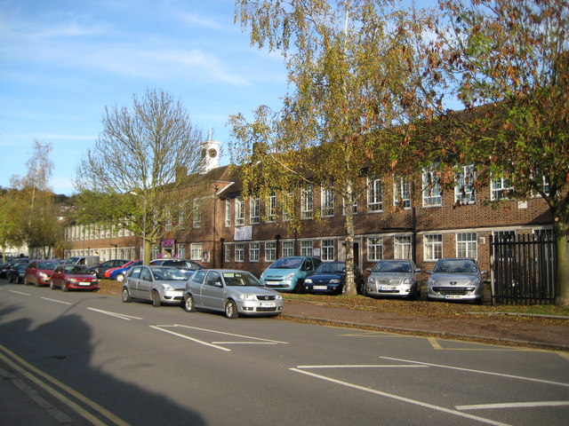
Image: © Nigel Cox Taken: 7 Nov 2009
As with many schools these days this one, in Mill End Road, has had a chequered history in terms of the age group that it has served, according to the prevailing dictats of both national and local government, and the changing demographics of the local population. Consequently it has had several names thus: 1936: Mill End Secondary School (11 to 16 year old children) 1973: Sands County Middle School (8 to 12 year old children) 1998: Sands Junior School (7 to 11 year old children) 1999: Millbrook Combined School (3 to 11 year old children) It is interesting to compare the Ordnance Survey's current 1:10,000 scale map with its equivalent from 1938 showing the school as originally built. Although the basic pattern is still the same, with a few extensions added, evidently the school originally had a central segment, as long as this frontage, which has now been broken in two to create a central courtyard. The whole building is topped by the attractive central clock tower which forms the School badge. As ever it is good to report that the clock was telling the right time. The School's website is here http://www.millbrook.bucks.sch.uk/default.asp
Images are licensed for reuse under creativecommons.org/licenses/by-sa/2.0
Image Location
Latitude
51.63711
Longitude
-0.779522