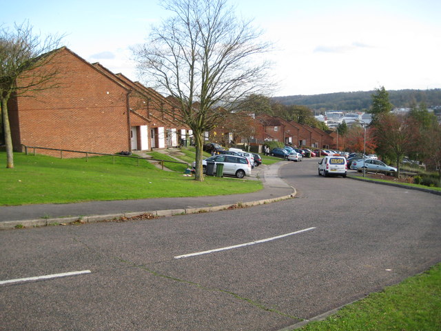
High Wycombe: Mendip Way
Introduction
The photograph on this page of High Wycombe: Mendip Way by Nigel Cox as part of the Geograph project.
The Geograph project started in 2005 with the aim of publishing, organising and preserving representative images for every square kilometre of Great Britain, Ireland and the Isle of Man.
There are currently over 7.5m images from over 14,400 individuals and you can help contribute to the project by visiting https://www.geograph.org.uk

Image: © Nigel Cox Taken: 7 Nov 2009
The staggered arrays of houses running up and down the hillsides on Mendip Way and its parallel roads, Cumbrian, Brecon and Cotswold Ways appear just as amorphous orange infills on the Ordnance Survey 1:50,000 scale map, but look at the larger scale 1:25,000 scale maps and they appear as a series of wriggly worms! Practically this is an interesting modern alternative to the stepped housing terraces that used to be built on steep hillsides.

