Disused railway bridge
Introduction
The photograph on this page of Disused railway bridge by Robin Drayton as part of the Geograph project.
The Geograph project started in 2005 with the aim of publishing, organising and preserving representative images for every square kilometre of Great Britain, Ireland and the Isle of Man.

There are currently over 7.5m images from over 14,400 individuals and you can help contribute to the project by visiting https://www.geograph.org.uk
Disused railway bridge
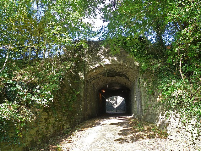
Image: © Robin Drayton Taken: 8 Oct 2009
In fact, this is two bridges. The railway which once crossed this bridge in the foreground has long gone. Immediately behind it is a modern bridge which carries the A4048 which was realigned at this point when the Chartist Bridge http://www.geograph.org.uk/photo/601707 was constructed. The location of this picture is just to the right of centre in this view http://www.geograph.org.uk/photo/872167 .
Images are licensed for reuse under creativecommons.org/licenses/by-sa/2.0
Image Location
Latitude
51.675972
Longitude
-3.191923