Battle of the Nile pub (site of). 39, Ainsty Street, Rotherhithe, London, SE16
Introduction
The photograph on this page of Battle of the Nile pub (site of). 39, Ainsty Street, Rotherhithe, London, SE16 by Chris Lordan as part of the Geograph project.
The Geograph project started in 2005 with the aim of publishing, organising and preserving representative images for every square kilometre of Great Britain, Ireland and the Isle of Man.

There are currently over 7.5m images from over 14,400 individuals and you can help contribute to the project by visiting https://www.geograph.org.uk
Battle of the Nile pub (site of). 39, Ainsty Street, Rotherhithe, London, SE16
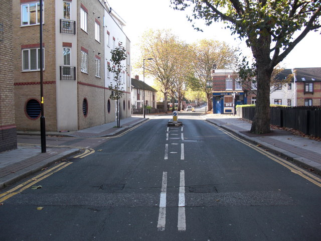
Image: © Chris Lordan Taken: 4 Nov 2009
Image shows Brunel Road and on the left is the junction with Ainsty Street that originally cut across Brunel Road and terminated at Rotherhithe Street. At one of the right hand corners of the junction stood the pub. It was built in 1814 and demolished in the 1930's after having served a time as a cafe. It may be considered too close to the pub in the background (Adam & Eve at No 33) but years ago in Rotherhithe there were many pubs that were closer still.
Images are licensed for reuse under creativecommons.org/licenses/by-sa/2.0
Image Location
Latitude
51.501641
Longitude
-0.050356