Ottery St Mary : The Square & Burning Tar Barrel
Introduction
The photograph on this page of Ottery St Mary : The Square & Burning Tar Barrel by Lewis Clarke as part of the Geograph project.
The Geograph project started in 2005 with the aim of publishing, organising and preserving representative images for every square kilometre of Great Britain, Ireland and the Isle of Man.

There are currently over 7.5m images from over 14,400 individuals and you can help contribute to the project by visiting https://www.geograph.org.uk
Ottery St Mary : The Square & Burning Tar Barrel
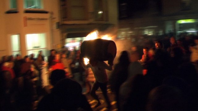
Image: © Lewis Clarke Taken: 5 Nov 2009
The barrels get heavier through the night. This barrel here is just an intermediate one.
Images are licensed for reuse under creativecommons.org/licenses/by-sa/2.0
Image Location
Latitude
50.751271
Longitude
-3.278706