Aberthaw Power Station - Breaksea Point
Introduction
The photograph on this page of Aberthaw Power Station - Breaksea Point by Mick Lobb as part of the Geograph project.
The Geograph project started in 2005 with the aim of publishing, organising and preserving representative images for every square kilometre of Great Britain, Ireland and the Isle of Man.

There are currently over 7.5m images from over 14,400 individuals and you can help contribute to the project by visiting https://www.geograph.org.uk
Aberthaw Power Station - Breaksea Point
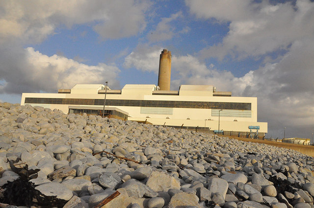
Image: © Mick Lobb Taken: 4 Nov 2009
The cladding of the structure is 'white' but seen here it is bathed in the light of a low autumn sun. The coast in the immediate area comprises quite large 'cobbles' that have been piled up by the high tides and storms that are common to this stretch of the Bristol Channel. At the low tide line there are exposed rocks that protect bands of sand. Despite the protective seawall it is not unusual after storms, coinciding with particularly high tides, to find large cobbles some distance inside the perimeter wire of the power station.
Images are licensed for reuse under creativecommons.org/licenses/by-sa/2.0
Image Location
Latitude
51.387255
Longitude
-3.408069