Former Wesleyan chapel, Goodmanham
Introduction
The photograph on this page of Former Wesleyan chapel, Goodmanham by Gordon Hatton as part of the Geograph project.
The Geograph project started in 2005 with the aim of publishing, organising and preserving representative images for every square kilometre of Great Britain, Ireland and the Isle of Man.

There are currently over 7.5m images from over 14,400 individuals and you can help contribute to the project by visiting https://www.geograph.org.uk
Former Wesleyan chapel, Goodmanham
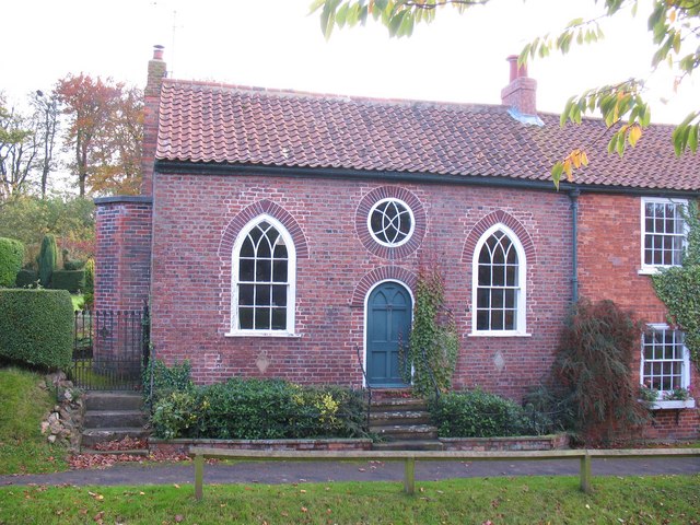
Image: © Gordon Hatton Taken: 29 Oct 2009
This former chapel dates from 1828 and stands opposite the church. It was converted to a dwelling as long ago as 1964.
Images are licensed for reuse under creativecommons.org/licenses/by-sa/2.0
Image Location


Leaflet Map data © OpenStreetMap
Latitude
53.876755
Longitude
-0.648643