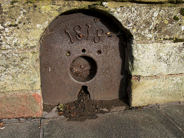
An old well plate at Greenlaw
Introduction
The photograph on this page of An old well plate at Greenlaw by Walter Baxter as part of the Geograph project.
The Geograph project started in 2005 with the aim of publishing, organising and preserving representative images for every square kilometre of Great Britain, Ireland and the Isle of Man.
There are currently over 7.5m images from over 14,400 individuals and you can help contribute to the project by visiting https://www.geograph.org.uk

Image: © Walter Baxter Taken: 2 Nov 2009
This metal face plate, dated 1878, is set into a low wall at the junction of Duns Road and The Square. For a wider view of this plate and wall against the backdrop of Greenlaw Town Hall undergoing renovation works, see Image The plate was originally a working part of a well that was built in this area when a new public water supply was introduced in 1878. The first public water supply into the town was brought from Well Tree springs.

