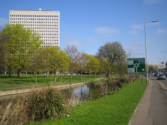
River Gade and the Kodak building, Hemel Hempstead
Introduction
The photograph on this page of River Gade and the Kodak building, Hemel Hempstead by Nigel Cox as part of the Geograph project.
The Geograph project started in 2005 with the aim of publishing, organising and preserving representative images for every square kilometre of Great Britain, Ireland and the Isle of Man.
There are currently over 7.5m images from over 14,400 individuals and you can help contribute to the project by visiting https://www.geograph.org.uk

Image: © Nigel Cox Taken: 22 Apr 2006
The River Gade viewed looking upstream along the A414 Two Waters Road towards the centre of Hemel Hempstead and the 'Magic' roundabout. The roundabout is formally called "The Plough Roundabout" after a former pub close by, but is known by all and sundry as the 'Magic', and originally was at the junction of six roads. The Wikipedia page states that "Traffic is able to circulate in both directions around what appears to be a main central roundabout (and formerly was such), with the normal rules applying at each of the six mini-roundabouts encircling this central reservation. It is a misconception that the traffic flows the 'wrong' way around the inner roundabout; as it is not in fact a roundabout at all, and as such no roundabout rules apply to it. Easy for locals, it presents a challenge for those who encounter it for the first time, and broken glass and plastic from minor collisions constantly decorate the road surface." At present the northernmost mini-roundabout does not have an incoming road to it. The 19 storey Kodak building is now no longer occupied by Kodak and has lost its distinctive rooftop logo since Image was photographed in July 2005.
Image Location


