Winchester in a nutshell
Introduction
The photograph on this page of Winchester in a nutshell by Graham Horn as part of the Geograph project.
The Geograph project started in 2005 with the aim of publishing, organising and preserving representative images for every square kilometre of Great Britain, Ireland and the Isle of Man.

There are currently over 7.5m images from over 14,400 individuals and you can help contribute to the project by visiting https://www.geograph.org.uk
Winchester in a nutshell
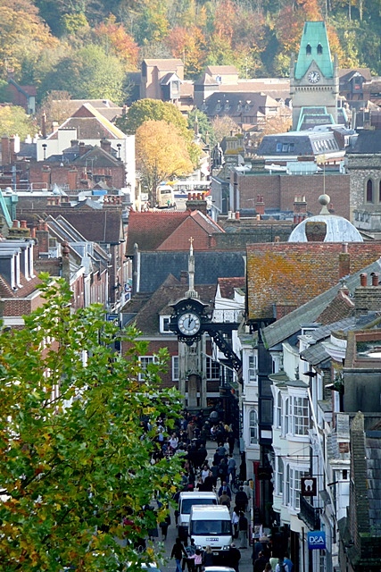
Image: © Graham Horn Taken: 28 Oct 2009
Taken from the roof of the 14th century Westgate, the main west-east layout of Winchester, defined since Roman times, can be seen here. The clock is on the old guildhall, with the buttercross underneath and beyond is the narrow street profile at the Pentice. The tall copper-green roof is the new (Victorian) guildhall. The coach is parked adjacent to King Alfred's statue at the east end of the city, with St. John's Hill beyond.
Images are licensed for reuse under creativecommons.org/licenses/by-sa/2.0
Image Location
Latitude
51.061922
Longitude
-1.31357