Aerial view of Hadleigh centre in the snow
Introduction
The photograph on this page of Aerial view of Hadleigh centre in the snow by Edward Clack as part of the Geograph project.
The Geograph project started in 2005 with the aim of publishing, organising and preserving representative images for every square kilometre of Great Britain, Ireland and the Isle of Man.

There are currently over 7.5m images from over 14,400 individuals and you can help contribute to the project by visiting https://www.geograph.org.uk
Aerial view of Hadleigh centre in the snow
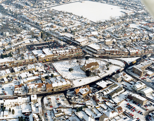
Image: © Edward Clack Taken: Unknown
The church in the middle of the picture is St James-the-less. The large building below left of this is The Castle pub. Most of the buildings lining the major roads here are shops. The large white rectangle at the top is a school playing field, with the school to the right.
Images are licensed for reuse under creativecommons.org/licenses/by-sa/2.0
Image Location
Latitude
51.553125
Longitude
0.609071