Corwen Rugby Club
Introduction
The photograph on this page of Corwen Rugby Club by ben dever as part of the Geograph project.
The Geograph project started in 2005 with the aim of publishing, organising and preserving representative images for every square kilometre of Great Britain, Ireland and the Isle of Man.

There are currently over 7.5m images from over 14,400 individuals and you can help contribute to the project by visiting https://www.geograph.org.uk
Corwen Rugby Club
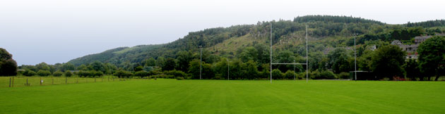
Image: © ben dever Taken: 22 Oct 2009
A view down the field towards Corwen Rugby Club, located on the Dee flood plain at Corwen.
Images are licensed for reuse under creativecommons.org/licenses/by-sa/2.0
Image Location
Latitude
52.981748
Longitude
-3.3777