Slicing through the houses
Introduction
The photograph on this page of Slicing through the houses by Peter Whatley as part of the Geograph project.
The Geograph project started in 2005 with the aim of publishing, organising and preserving representative images for every square kilometre of Great Britain, Ireland and the Isle of Man.

There are currently over 7.5m images from over 14,400 individuals and you can help contribute to the project by visiting https://www.geograph.org.uk
Slicing through the houses
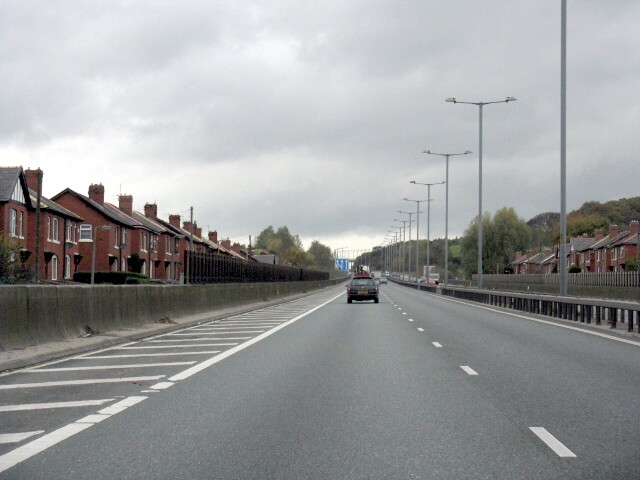
Image: © Peter Whatley Taken: 28 Oct 2009
In my opinion, one of the worst pieces of road building in the UK. At this point east of Bury, the M66 was built decidedly "on the cheap", leaving houses on both sides within a few feet of the carriageway, their neighbourhood rent asunder, an inadequate hard shoulder and only two lanes despite the steep climb. In the distance, the road gains a much-needed crawler lane for slower traffic.
Images are licensed for reuse under creativecommons.org/licenses/by-sa/2.0
Image Location
Latitude
53.603977
Longitude
-2.274247